![](/images/other/stat-length.png)
![Randonnée A pied Rudawka Jaśliska - Beskidzka Trasa Kurierska „Jaga–Kora” - Photo](https://media.geolcdn.com/t/1900/400/f90df1f1-6996-4792-9b83-1d523c59fa51.jpeg&format=pjpeg&maxdim=2)
Beskidzka Trasa Kurierska „Jaga–Kora”
SityTrail - itinéraires balisés pédestres
Tous les sentiers balisés d’Europe GUIDE+
![Longueur](/images/other/stat-length.png)
![Altitude max](https://static1.geolcdn.com/siteimages/upload/files/1508320355ic_sort_altitude_max_24dp.png)
![Dénivelé positif](https://static1.geolcdn.com/siteimages/upload/files/1508320355ic_sort_den_pos_24dp.png)
![Km-Effort](/images/other/stat-length.png)
![Altitude min](https://static1.geolcdn.com/siteimages/upload/files/1508320355ic_sort_altitude_min_24dp.png)
![Dénivelé négatif](https://static1.geolcdn.com/siteimages/upload/files/1508320355ic_sort_den_neg_24dp.png)
![Boucle](https://static1.geolcdn.com/siteimages/upload/files/16400158638029165_repeat_loop_refresh_sync_direction_icon.png)
![A pied](https://static1.geolcdn.com/sitytour/trail-icons/100.png)
1h55
Difficulté : Facile
![Scannez ce code QR pour ouvrir la randonnée dans l'application SityTrail](https://capi.geolives.com/qq0zvz2zws4bq2lad0pu/sitytour/trails/3127674/qr.png?size=200)
Application GPS de randonnée GRATUITE
À propos
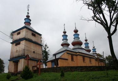
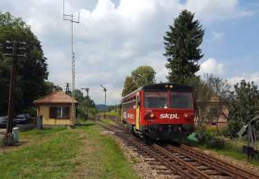
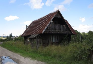
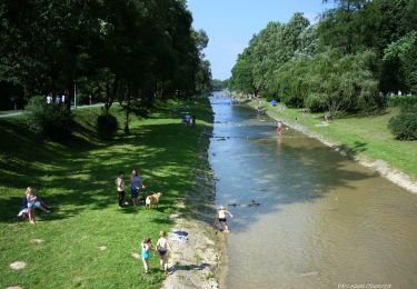
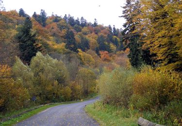
Randonnée A pied de 7,5 km à découvrir à Basses-Carpates, powiat krośnieński, Rudawka Jaśliska. Cette randonnée est proposée par SityTrail - itinéraires balisés pédestres.
Description
Zmieniłem kolor szlaku na czarny w celu poprawienia czytelności na mapach. W pewnym momencie równolegle przebiegały trzy czerwone szlaki.
Symbole: Białe tło : Czerwony symbol Polski Walczącej
Localisation
Commentaires
Randonnées à proximité
![Randonnée A pied Rymanów-Zdrój - Trasa Fitness - Photo](https://media.geolcdn.com/t/375/260/dbff1d05-3902-4857-bca6-222a0b51bd9d.jpeg&format=jpg&maxdim=2)
![A pied A pied](https://static1.geolcdn.com/sitytour/trail-icons/100.png)
A pied
![](/images/other/stat-length.png)
![](https://static1.geolcdn.com/siteimages/upload/files/16400158638029165_repeat_loop_refresh_sync_direction_icon.png)
![Randonnée A pied Iwonicz-Zdrój - Rymanów Zdrój - Iwonicz Zdrój - Photo](https://media.geolcdn.com/t/375/260/8eb1bf63-71fa-4f20-8bb7-82b0468656b1.jpeg&format=jpg&maxdim=2)
![A pied A pied](https://static1.geolcdn.com/sitytour/trail-icons/100.png)
A pied
![](/images/other/stat-length.png)
![](https://static1.geolcdn.com/siteimages/upload/files/16400158638029165_repeat_loop_refresh_sync_direction_icon.png)
![Randonnée A pied Daliowa - Szlak spacerowy Stasiana - Dukla - Photo](https://media.geolcdn.com/t/375/260/386a73a4-1f10-485d-ab08-190ab9124a60.jpeg&format=jpg&maxdim=2)
![A pied A pied](https://static1.geolcdn.com/sitytour/trail-icons/100.png)
A pied
![](/images/other/stat-length.png)
![](https://static1.geolcdn.com/siteimages/upload/files/16400158638029165_repeat_loop_refresh_sync_direction_icon.png)
![Randonnée A pied Komańcza - Ścieżka przyrodniczo-historyczna po Komańczy - Photo](https://media.geolcdn.com/t/375/260/bae894ee-b219-4094-87ae-432d6aed0817.jpeg&format=jpg&maxdim=2)
![A pied A pied](https://static1.geolcdn.com/sitytour/trail-icons/100.png)
A pied
![](/images/other/stat-length.png)
![](https://static1.geolcdn.com/siteimages/upload/files/16400158638029165_repeat_loop_refresh_sync_direction_icon.png)
![Randonnée A pied Kulaszne - Śladami dobrego wojaka Szwejka - Photo](https://media.geolcdn.com/t/375/260/b1f127c5-7746-41ab-83e7-5c16dffdcc81.jpeg&format=jpg&maxdim=2)
![A pied A pied](https://static1.geolcdn.com/sitytour/trail-icons/100.png)
A pied
![](/images/other/stat-length.png)
![](https://static1.geolcdn.com/siteimages/upload/files/16400158638029165_repeat_loop_refresh_sync_direction_icon.png)
![Randonnée A pied Rzepedź - Jawornik - Wahalowski Wierch - Photo](https://media.geolcdn.com/t/375/260/9bc0b63f-233f-4e05-9383-f3c0b5ec6c6a.jpeg&format=jpg&maxdim=2)
![A pied A pied](https://static1.geolcdn.com/sitytour/trail-icons/100.png)
A pied
![](/images/other/stat-length.png)
![](https://static1.geolcdn.com/siteimages/upload/files/16400158638029165_repeat_loop_refresh_sync_direction_icon.png)
![Randonnée A pied Rymanów-Zdrój - Ścieżka przyrodnicza Rymanów Zdrój - Photo](https://media.geolcdn.com/t/375/260/36ed06ea-ab8f-46e8-9bd6-9eb4ffed6860.jpeg&format=jpg&maxdim=2)
![A pied A pied](https://static1.geolcdn.com/sitytour/trail-icons/100.png)
A pied
![](/images/other/stat-length.png)
![](https://static1.geolcdn.com/siteimages/upload/files/16400158638029165_repeat_loop_refresh_sync_direction_icon.png)
![Randonnée A pied Daliowa - W przełomie Jasiołki - Photo](https://media.geolcdn.com/t/375/260/0831bde8-76be-49d8-ba85-5ab41da34b93.jpeg&format=jpg&maxdim=2)
![A pied A pied](https://static1.geolcdn.com/sitytour/trail-icons/100.png)
A pied
![](/images/other/stat-length.png)
![](https://static1.geolcdn.com/siteimages/upload/files/16400158638029165_repeat_loop_refresh_sync_direction_icon.png)
![Randonnée A pied Zyndranowa - Zyndranowa Schronisko - Jaśliska - Photo](https://media.geolcdn.com/t/375/260/f895d9b2-c73f-4868-aa0b-6d4afdbf84f8.jpeg&format=jpg&maxdim=2)
![A pied A pied](https://static1.geolcdn.com/sitytour/trail-icons/100.png)
A pied
![](/images/other/stat-length.png)
![](https://static1.geolcdn.com/siteimages/upload/files/16400158638029165_repeat_loop_refresh_sync_direction_icon.png)